Friday, April 29, 2011

North Into North Carolina

Our friends Nadine and Louis leaving Georgetown, SC on Gaia
the 60 foot catamaran Louis built.


The Exuma Youth Band could have used a boat like this.
Should it be painted yellow to be a school boat?


One of several eagles seen on the ICW.


The osprey nest right by our anchorage.


One of the pair of osprey feeding behind our boat.


Maybe these little guys are why Matt didn't like this anchorage.

Thursday, April 28, 2011

Character of the ICW

The weather forecast today was 100% chance of rain, with strong winds to 30 mph, and possible severe thunderstorms. Later in the day they added a tornado watch. The anchorage at Georgetown isn’t rated very well for holding, and isn’t very big if the wind shifts around very much or if boats anchor too close. We were reluctant to weather a big storm there, and the wind direction would allow us to motor-sail the ICW so we decided to leave first thing this morning. It turns out the anchor was set very well so riding out a storm probably would have been OK. At any rate we left early, got a nice assist from the following winds, and never had any bad weather. We are now anchored in the Waccamaw River which I think is probably my favorite anchorage of the whole trip. This is where we anchored with Matt in November where he wanted us to leave a night light on because he thought it was kind of creepy. In November all the leaves were off the trees. Now there are leaves on the trees, turtles sunning themselves on logs, and a couple of nesting ospreys who are feeding in the nearby trees. Tomorrow we should be at the South Carolina border, or possibly in North Carolina.

Tonight we had salad, fresh strawberries, smoked oysters, kippered herring, smoked salmon, cheese and crackers, and applesauce.

In very general terms the ICW is different from state to state. Southern Florida has the condos and metro areas that go on for miles. Generally shallow water and fairly straight, almost canal-like stretches with houses along the way. The tides in Florida are only a couple of feet. The ICW in Georgia meanders back and forth in a more remote or marsh/swamp setting. With a tidal range of up to 10 feet it can have some of the shallowest water of the whole ditch. South Carolina has several large cities and towns along the way, and portions of the waterway seem to be relatively straight canal-like sections bordered by homes and docks. Now as we approach North Carolina the tides are getting less extreme, and the waterway is again winding its way through a more natural, apparently uninhabited wilderness. Until we stopped today we saw only four boats moving on the ICW. If you didn’t look at a road map you could believe you were the only people for miles. Today turtles on logs have replaced the sea turtles we’ve been seeing in the ocean and near the passes coming in from the sea. We’ve passed dozens of osprey nests built on the navigation marks in the waterway. A couple of days ago we saw several eagles.

There is so much tannin (a brown, tea-like stain) in the water that boats get a “mustache” above the waterline at the bow. Three months of crystal clear water in the Bahamas had almost erased Passage’s mustache. Now it is back, getting darker by the day.

Wednesday, April 27, 2011

Georgetown, SC... as opposed to George Town, Great Exuma

We left Charleston Monday morning.  Things started going badly even before the day started.  First, we noticed over the weekend that the refrigeration would not run on batteries alone.  We called the fridge repair guy but of course it was Easter Sunday, so we didn't expect to hear from him until Monday.  We bought some ice to tide us through.  Then as we were getting under way Monday morning the windlass quit working with the anchor chain only part way up, so Richard had to pull it up by hand.  Just after that I overlooked a big tug pulling a long line of pipe.  I thought it was continuing up the river but instead it was turning, and I cut across its path.  Not a safe way to start the morning.  After motoring across Charleston harbor we approached the entrance to the ICW about the time the fridge repair guy called.  Richard indicated that I should circle back into the harbor so as to avoid the narrow entrance and congestion there while he was on the phone but as soon as I turned around we ran aground.  We thought it was very convenient that TowBoat U.S. was there immediately but they were coming for another boat, also aground.  However, we didn't have to wait long for the tide to rise and we were able to power off.  Richard finished talking with the fridge guy, who thought our problem was battery related, since it runs on engine power just fine.  We continued up the ICW after talking with a north bound trawler, who we asked to let us know if he saw any really shallow depths.  They called a couple times to alert us to a few spots.  Our guidebook warned of one spot in particular and said there was more water on the left side of the channel, so when we got there and saw a large power boat coming up behind, Richard started moving left to let him by.  Suddenly we went from 9+ feet of water to 4.9 feet and were hard aground!  I had been standing in front of the companionway looking aft.  We stopped so suddenly that I was thrown backwards, into the open companionway.  We had a screen covering it to keep out the bugs (flying teeth!) and that is all that prevented me from having serious injuries, as it slowed my fall down the steps.  Of course, the wooden slats in it broke and the screen ripped, so I spent the next three hours sewing it back together (have to keep the bugs out or we'll go nuts!).  A local boat which stopped to help said that if we had gone another 50 yards in the ICW we would have missed the shallow ledge which grounded us.  We decided to wait for higher tide to float us off and to give us more water in the channel.  We continued on, stopping early for the night, and continued on to Georgetown, SC the next day.  There we found our friends on Gaia.  They stopped over after they (and we) had run errands in town.  Louis and Richard worked on tracking down our battery/refrigeration problem (nothing conclusive).  Afterward I fixed dinner and we all had a nice meal and conversation.  They departed early so that they could get up early for their planned 50 mile day in the morning.  We never did get to watch Captain Ron with them.  There is a good chance we will not see Nadine and Louis again on this trip.  They are planning longer travel days days in an effort to be back in Quebec by July.  We are doing shorter days, and have people and places yet to see on our return to the Great Lakes.

Richard here.  We were both a little bummed this morning after Louis and Nadine left.  They are the boat that we've seen most often (since the Annapolis boat show in October) and the people that we've spent the most time with both in the Bahamas and now on our return up the east coast.

After lunch and most of the rain showers were finished we walked into town to do laundry and buy a few groceries.  As I was helping fold the laundry I realized that most of our clothes will need to be replaced after this adventure.   Between wearing our clothes just a bit longer than usual between launderings,  sunscreen stains, and bug blood stains most of our clothes are looking a bit ratty.  Of course those of you who know how I dress probably wouldn't notice much of a difference, but Sue will definitely be buying new clothes!

I also noticed that we're both sort of out of the tourist mode at this point in our trip.  We've walked by two or three museums lately without even asking each other if we have any interest in stopping.

Monday, April 25, 2011

Easter in Charleston

Friday we moved half way from Beaufort to Charleston. We shared a nice quiet and remote anchorage with Gaia, the French-Canadian catamaran we have been seeing off and on since the Annapolis boat show. They invited us to dinner so Sue baked a chocolate cake for dessert. We caught up on our respective adventures since George Town in the Bahamas. The next time we see them will probably be Georgetown, SC. We’re going to invite them over to watch Capt. Ron, which they haven’t seen! It must be a French thing.


Sunday we took the dinghy ashore to explore Charleston again. When we were here in the fall we didn’t spend a great deal of time in the city because the marina we were in was so far out of town. Since then they have made three trolley line routes free.


We rode a couple of trolley loops to get an overview of the city. Then we jumped off at different spots to see specific sights. We also took one of the guided carriage tours.

Our carriage horse Danny.
Our carriage guide is a student at the College of Charleston. He was telling us of the favorable female to male ratio (5:1) in Charleston. I hadn’t really noticed that, but I have noticed that the bikinis are blooming all along the Intracoastal.  Not at all a bad thing when you are near college towns.
These "gals" were dressed for Easter, not in bikinis!
The "Wedding Cake" house.

One of the wading fountains in Waterfront Park.

Thursday, April 21, 2011

Back in Bewfort (as opposed ot Bowfort)

First, apparently I didn't do a very good job explaining how the high tide flooded the parking lot at the Hinkley Yard.  Because the tide can be over 10 feet most of the marinas in the area having floating docks.  Hinkley has about a 30 foot ramp which is hinged at the shore/parking lot end.  The other end just rests on the floating dock and can go up and down with the tide.  When the tide is out the ramp angles down about 45 degrees from the parking lot to the dock below.  When the tide is really high the ramp angles up from the parking lot about 5 degrees.  When we got back to the boat yard with the last full-moon-high-tide the shore side of the parking lot was under water so we would have had to wade across the parking lot to get to the end of the ramp.  I think I might have a picture of the ramp.

I hope that clears things up.

Tuesday morning Jamie came back to see how our refrigeration was working - so far, so good.  With the high 80 degrees temps we're having we're both really glad to have cold food and drinks again.  To celebrate Sue bought steak and corn on the cob for supper last night, and tonight we had salad and pork loins.

After lunch Tom and Diane picked us up again and we all went out to Fort Pulaski, another brick Civil War fort.


Then we drove back to Savannah and did more of our walking tour.  Here are the four of us in front of the fountain at Forsyth Park.


I really love the Spanish moss in all the trees here.  I'm really going to miss the moss and the palm trees as we work our way north.

I know this isn't a dogwood; no bark.  (Get it?)
After a little more walking we had dinner at "One eyed Lizzie."  I didn't think it was quite as good as "Moon River" the night before.  Between the four of us we tried gouda cheese potatoes, a pulled pork sandwich and a pulled pork wrap, a beef fajita, grouper fingers, a shrimp quesadilla, and a grouper Reuben.  For an appetizer we all tried 20 or 30 different flavored peanuts at a speciality nut shop.

Wednesday we gave Diane and Tom the day off while we cleaned the deck of the boat.  Fresh water, chemical cleansers... what a concept.  Come to think of it, why did we give Tom and Diane the day off?
Today we made it back to Beaufort, SC.  I think tomorrow we'll go about half way to Charleston.
Right now we are seeing lightening and hearing thunder all around us, but so far no rain.

Tuesday, April 19, 2011

Sights and sounds around Savannah

We got a dock at Hinkley Yacht Services (as close as we'll ever get to a Hinkley, Mark!).  Jamie, the refrigeration technician, showed up about an hour later.  After a couple of false starts he thought he had figured out our problem.  When he left our ice box was getting cold.  He plans to stop back this morning to check things out, and maybe make one modification to the system.  After lunch we decided to walk to the grocery store to get food that we can now keep cold.  As we were walking to the Piggly-Wiggly (don't you love the name?) our friends from back home Tom and Diane called.  They keep their Hunter sailboat at North Cape where we dock our boat.  They have been spending the winter in Savannah visiting their son who flies military helicopters.  They have a wonderful little "cottage" right in the historical district of Savannah.  They are within walking distance of the riverfront and all the little squares that Savannah is famous for.  Savannah is a great city for walking.

Diane and Tom picked us up at the grocery store and took us back to our boat.  Then we went downtown for a nice walking tour.  We had dinner at a little micro-brewery, Moon River, and then went back to their cottage to talk sailing and cruising.  Time sort of got away from us, and by the time we got back to the Hinkley Yard the gate was locked.  Sue thought she could climb over the fence between the barb wire on top.  About the time she was half way up I noticed someone walking up behind us.  Great, we're going to get busted breaking into Hinkley!  It turns out Joe was on the boat docked right behind us, and knew the gate lock combination.  He opened the lock thinking Tom and Diane wanted to drive into the yard.  It turns out there was a small unlocked gate right next to the drive through gate that none of us had noticed!  As we turned the corner to walk out the dock to our boat we noticed that the full moon tide had flooded our approach.  Joe said we could wade out, or wait a few minutes for the tide to recede.  We opted to wait, and Joe told us a bit of his story.  He is from Kingston, Ontario.  He has been here for about 3 years getting his boat ready to sail to Cuba, and then to Europe to tour the rivers and canals.  Apparently "island time" is not just for the islands.

From our dock at Hinkley.

Tom, Diane & Sue waiting for the buggy.

One of the many squares in Savannah.

Be careful of the river view from some of the balconies!

We haven't seen Marilyn since Key West.

Sunday, April 17, 2011

Odds and Ends...

Georgia has some of the highest tides on the ICW, up to 9 feet at times. It makes anchoring interesting. If you anchor at mid or high tide in water only a couple of feet deeper than your draft you might be very surprised once the tide has gone out completely. We try to watch the state of the tide pretty carefully. We are anchored in a small river just off the ICW. We came in at low tide and had plenty of water but we couldn’t see much over either bank of the river. When the tide came up if flooded all the surrounding lowlands, and our view improved dramatically. It was also windy enough today (average 15 to 20 kts, gusting to 30 kts) that most of the time the boat stayed oriented to the wind, not the changing tides.

When we were coming across the Gulf Stream south of Cape Canaveral I spotted a rather interesting notice on the chart:
“The heavy dashed magenta lines represent the limits of launch hazard areas associated with the majority of launches from Cape Canaveral. Launch debris may fall within these areas.” This notice was a ways south of the “Unexploded Ordnance” regions we passed through. Just a couple more things we never learned about sailing on Lake Erie!

In the Bahamas the day time temps and night time temps never varied by more than 5 or 6 degrees - maybe 10 degrees max if a front came through.  This morning the temperature was under 60, while yesterday it had been almost 90 degrees.

Now that we are back in the ICW the water looks more like coffee or tea - so much for the crystal clarity where you could see the bottom in over 20 feet of water.


The hand-wind mechanism of the Hope Town lighthouse.

<>
Rush hour - Man O War Cay

Our view at low tide at our last anchorage

Our view at high tide

Thursday, April 14, 2011

Walking through Georgia

Yesterday morning we left Fernandina, Florida heading north through Georgia by way of the ICW (Intracoastal Waterway).  Except for the no-see-ums we had a rather uneventful day - not a bad thing at all.  When we came through Georgia last fall it was late enough in the season that bugs really weren't a problem.  Now with the warm temperatures and all the low marsh areas that we are travelling through the bugs are really a problem.  You can't be out for more than a couple of minutes without feeling like you are being eaten alive.

This morning we had to leave our anchorage relatively early before the tide went out enough to strand us.  Then we had to anchor for two hours around noon to wait for the tide to come up enough so we could transit the Little Mud River.  Supposedly this is the worst section of the ICW in terms of shallow water.  There was another boat anchored waiting for the tide to come in, and before we both left a third boat arrived to wait with us.  They both drew less water than we do so we followed them through.  By waiting we had plenty of water, and it is nice to have this shallow section of Waterway behind us.  We saw two alligators today - a first, and several dolphins.

Now for today's adventure.  One of the boats we followed through Little Mud anchored the same place we did and invited us over for drinks - tea, as they are British.  As were we talking a power boat came in and anchored what we all thought was too close to both our boats.   Later back on our boat when the tide started to switch the power boat ended up being less than 100 feet from our boat.  They realized they were too close and moved to another spot - last boat anchoring, first boat to move.  As we were watching them move we realized our anchor was behind our boat, and the other sailboat - which had anchored first - was suddenly also very close to us.  Since they had dropped their anchor first we figured we should move, even though they were spinning around in strange circles.  It took us a while to raise our anchor since the chain was going under and behind the boat.  You have to be careful that you don't wrap the chain around the rudder or keel, or worse, catch the chain on the propeller shaft.  About the time we were dropping anchor in our new spot we noticed that the sailboat was also pulling up their anchor and moving.  It turns out they had been dragging their anchor, and if we had waited a few more minutes we wouldn't have had to move.  We watched them try to re-anchor for about 10 minutes before they finally tried a new spot.  So three boats anchored, and then all re-anchored - though I think we really didn't need to.  At least all this happened before sundown.

As we motor against the tide a lot of the time our speed over the ground (SOG) is under 4 knots.  And when the tide is out often there are mud flats visible along either side of the Waterway.  Thus at times our pace is that of a brisk walk, though pulling your feet out of all the mud might slow you down a bit.

Swimming pigs at Staniel Cay.
The pigs associate the sound of boat motors with food and swim out to meet the boats.
They even try to climb into the boats - not great with an inflatable boat!
Not a good enough cell signal for any more pictures, sorry.

Tuesday, April 12, 2011

Unwinding in Fernandina

Saturday afternoon after showers, donuts, and a little sightseeing we decided to look for the local supermarket.  We were looking for a Publix, a Winn Dixie, or a Wal Mart though there seemed to be no definitive answer as to how far away any of them were.  Sue decided to Google their locations from the boater's lounge at the marina.  As she was doing that another boater offered us the use of their boat bikes.  Fresh with a little computer-local knowledge we headed off.  It turns out the computer had never been to Winn Dixie and directed us to a residential neighborhood a mile and a half out of our way.  We rode back to the historic part of town by the marina and then headed in the general direction we thought the grocery store might be.  We stopped to ask directions and found that we were going in the right direction.  The little strip mall had a  Subway sandwich shop, a huge Dollar Tree store, a large Winn Dixie, a nice Chinese buffet, a Radio Shack, and a Wal Mart (non super center).  As boaters who had just spent the last three months in the Bahamas we felt like we had found shoppers paradise!  After buying everything we thought we could carry on the bikes (including a dozen donuts!) we decided to have supper at the Chinese buffet.  It was all very good and they even had mint chocolate chip ice cream.  We returned the bikes just as it was getting dark and got back to the boat pretty much stuffed.

Sunday morning Sue decided we needed more clean clothes.  So when she did laundry I decided to walk back to Wal-Dixie to buy a few things we should have bought when we had wheels.  It turns out the shopping center is just a bit over 2 miles away and ends up being about a half hour walk.  Since it was about 87 degrees I decided I should have an emergency ice cream ration just in case I got too hot on the way back to the marina.  I bought a Klondike Bar for myself and an ice cream sandwich for Sue.  About half way back to the boat I ate mine.  About three quarters of the way back I noticed Sue's was melting because of the heat and was forced to throw it a way.

After lunch we decided to explore the historic district in Fernandina.  Lots of the houses are gorgeous with Spanish moss-draped live oak trees in the yards.  On the way we ran into the marina manager.  We were telling him how much we like Fernandina and the marina facilities - if only they had a loaner car or bikes to rent.  He said that on Monday they would be starting a bike rental program.  I asked if the bikes had been checked out before people were expected to plunk down money for them.  He said they were all brand new bikes, but that a test ride might not be a bad idea.  He let Sue and I each take one of his new bikes - we just had to return by 8:00 pm!  How nice was that?   We rode up one block and then down the next.  When we finished the east-west streets we did the same thing with the north-south streets.  I think we saw every historic house in town, and then some.

Monday we called around to see if someone could take a look at the refridgeration system on the boat.  Tuesday afternoon was the earliest the technician could meet us so we spent another day walking around town.  Today after filling our diesel tank and our water tank the refrigeration guy showed up.  We have a bad compressor or a bad electronic control module.  He doesn't have either part so we're stuck without cold food and drinks for a while longer.  Tomorrow we start heading north again - he suggested a place in Savannah to check for parts and service.

And in the "It's a small world" department,  A boat we rafted off in Vero, ("Velcro") Florida around Thanksgiving is on the next mooring ball.  We'll have to compare notes about our winter travels.
Last night we watched two episodes of "House" on line.  This is the first television we've seen in over 6 months except what has been on in stores or marinas.


Banker's hours on Man-O-War Cay


Satellite view of Hurricane Flloyd, 1999


Harvey Gammage, 130 foot school schooner
Sails from Maine to the Caribbean
with high school or college students


Gulf Stream conditions to make one sick


Green Turtle Cay Club - wallpapered in $ bills


Typical exposed plumbing in Bahamas

Tree in street, Fernandina Beach


One of the nicer houses in Fernandina


Speed over the ground while motoring around 5 knots


Sue on rust removal detail.
I felt guilty doing nothing so I took pictures


Saturday, April 9, 2011

Back to the States, part 2

The rest of the Gulf Stream crossing was uneventful - the best kind of crossing.  We kept seeing freighters but not much else.  We saw a few dolphins and another sea turtle or two.  Once we angled our way out of the Stream our ground speed started to drop - bummer.  Another aspect of the theory of relativity became obvious during this crossing.  Back home we hardly ever sail 50 miles as a day sail.  And if we are cruising and our destination is 50 miles or so we get up early and plan for a long day on the water.  This trip ended up being 370 miles and when we had whittled the miles down to 50 miles we felt like we were almost there.  Fernandina was just around the next corner and we could almost taste the ice cream.  The only problem was we couldn't see the next corner.  Back home, and most places we've cruised, you can see land or structures on shore from 15 to 20 miles off shore.  Florida is so low and undistinguished (sorry, all you Florida residents) at this point that we didn't see land until we were about 7 miles away.  Later on I figured out why.  If you remember the green flash incident you remember I have a red-green color vision issue.  Since Florida is a "red state" in most elections I'm sure that's why I couldn't see it.

We eventually made it to the marina at Fernandina and were able to clear customs back into the States.  That's another story, but we are back legally.  Customs is closed weekends so our arrival timing was good. I just hope the terrorists and illegals only try to enter on weekdays.  We had seafood at a nice little local restaurant - the biggest meal we've had since Christmas.  This morning we got our showers and found a bakery for cream filled donuts.  We also made it to the weekly farmer's market.  Fernandina is pretty nice, but it would have been nice to see Mary and Dave in Daytona again.  I imagine Dave is glad we won't be abusing the shocks and springs in his car again with another shopping trip to Sam's Club.

Loyalist Park, New Plymouth, Green Turtle Cay

New Plymouth

Blundering our way across the Gulf Stream, or, Back in the U S of A...

The weather forecast indicated higher winds that would let us sail at  least some of the way so we left Green Turtle Cay Wednesday morning after spending 3 days there.  To our surprise not everyone left.  We had a nice sail the first 70 miles.  We had planned to stop at Great Sale Cay and then leave first thing Thursday morning on what we figured to be a 48 hour passage to Fernandina Beach, Florida.  This would have been a day-night-day-night trip, timing our arrival for daylight, and giving us the next daylight hours if we needed them.  But since there was wind to sail we kept on going, as the next 2 to 3 day forecast was for very light wind.  Only after we had committed ourselves did it occur to me that we were now on a night-day-night-day schedule, and if we made slower progress our arrival would be after dark.

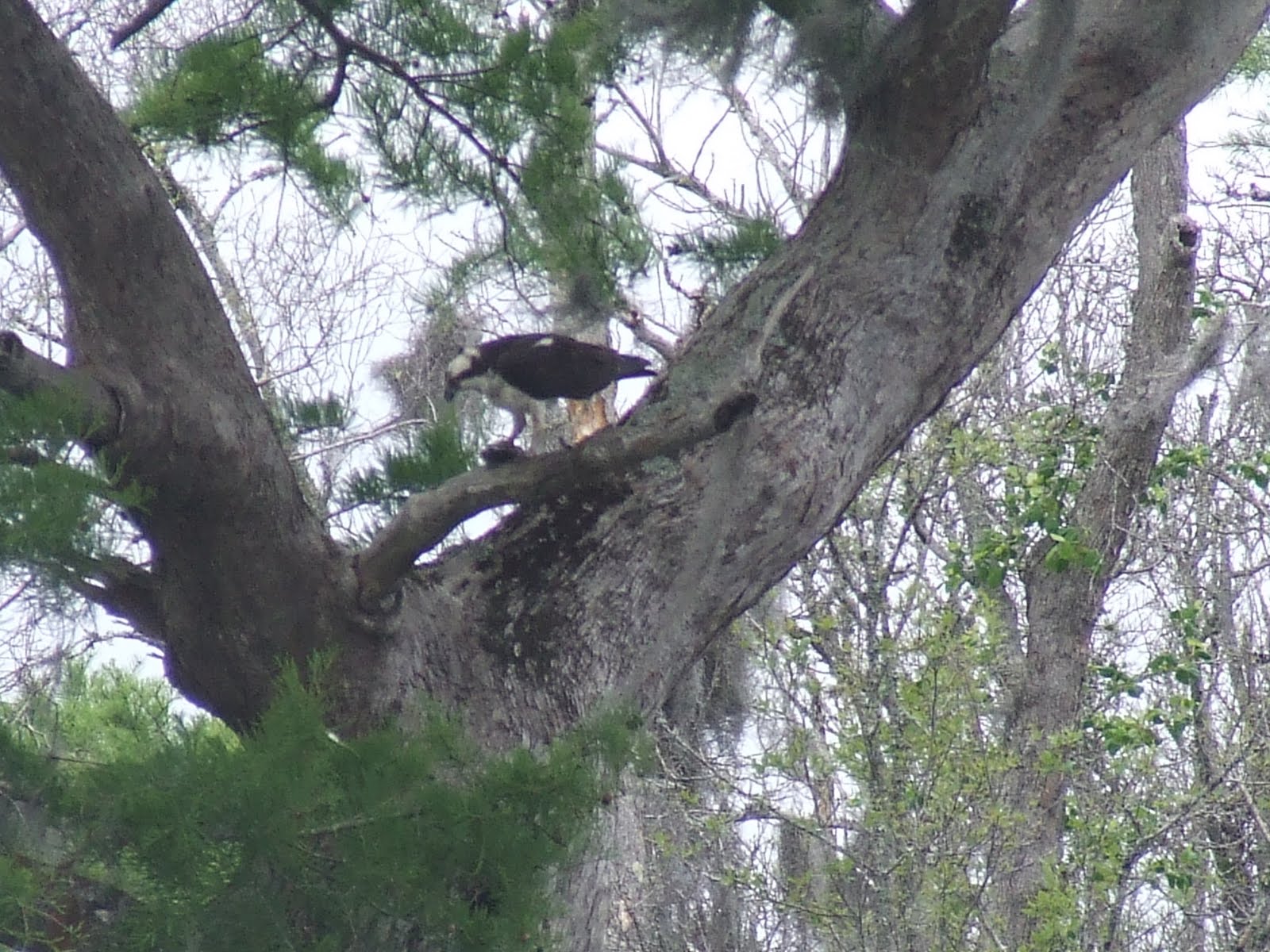
About 12 miles after passing the potential anchorage the wind went light enough that we had to start motoring.  As a slight consolation we saw a huge sea turtle.  His body looked to be about 3 feet in diameter, with a head about the size of a basketball.  The hunting and trapping of sea turtles was only outlawed in 2009 in the Bahamas.  We had about 40 miles to travel due west across the Little Bahama Banks to clear shoals before we could turn NW to head for Florida.  Once we turned NW we kept expecting to get a boost in speed from the Gulf Stream but it didn't happen.  After a few hours it occurred to me that we were paralleling the Stream and not really crossing it.  What we needed to do was turn away from our destination and go due west to hit the middle of the Stream.  When we changed course our travel time jumped to over 66 hours which was pretty depressing.  It also made we wonder if we would have enough fuel to motor that long.  Eventually we got into the Gulf Stream and turned due north.  Even though our speed through the water was only 4.5 to 5 knots, our ground speed soon indicated 9 to 10 knots!

Now our travel time started to decrease but our new course was taking us through rollers or swells left over from earlier NE winds on the Atlantic.  The motion was bad enough that Sue started to get queasy, even though she hadn't been seasick in almost 25 years.  The motion didn't particularly bother me but it was annoying because the noise from all the rolling made it difficult for me to sleep.  Now that we were finally riding the Stream we had to decide how far we could go north before we would have to turn out of it and head to Florida.  After some calculations, some trial and error route plans, and finally just a wild ass guess we decided we would stay in the Stream for over a hundred miles and then angle out towards Fernandina, which would be another 90 miles.  GPS predictions indicated pretty much the shortest travel time.  Now all we had to do was try to sleep (Sue could, sort of, but I couldn't) and look out for ships.

Once we passed Great Sale Cay we never saw another cruising boat.  But once we got in the Gulf Stream we started seeing freighters.  Since they travel around 20 knots, and we were traveling around 10 knots, the closing time might not be very long, depending on the relative courses.  Our VHF radio has an AIS feature  (Automatic Identification System), which is supposed to show the position of commercial boats and ships.  It shows the ship ID, its course and speed, and how close and when it will pass our boat.  It's kind of like radar (as long as the ship has their AIS activated) and was very reassuring with all the big ship traffic we saw.  (Navy warships don't broadcast an AIS signal - go figure!)  At one point in the middle of the night our AIS indicated a freighter coming up right behind us and passing within a quarter mile of us.  Since we had the whole Atlantic Ocean to play with I figured that was a bit close.  I called him on the radio to ask him which way he would like us to move and he responded that HE would change course (a collision at sea pretty much ruins everybody's day!)  Another cruising boat about 20 miles behind us heard our call and then called us to ask our opinion about whether he could run his diesel without the alternator, as the bracket had broken.  (I told him I thought the diesel would run OK but he would lose the water pump, which was driven by the same belt.)  We then talked about the Gulf Stream and our destination of Fernandina.  As soon as that call ended another cruising boat about 20 miles ahead of us called us to give us information about getting into Fernandina.  So there we were, in the Atlantic Ocean, out of sight of land and other cruising boats, thinking we were the only cruising boat out there, discussing diesels and destinations.  Technology sure can be a wonderful thing.

Sue tells me it's time to take showers - our first stand up, use all the hot water you want, since Marathon, Florida around the end of last year!  I'll tell you "the rest of the story" (remember Paul Harvey?) later.

Sunday, April 3, 2011

The latest from Green Turtle Cay.

Right now we are at the Leeward Yacht Club on Green Turtle Cay in the Abacos.  We have honest to goodness internet access, iced drinks, and a view of Black Sound.  Friday we had our first real rain since we've been in the Bahamas.  It rained for about two hours during the night and then in the morning.  In spite of the fairly heavy rain it wasn't enough to put out some brush fires that have been burning around Marsh Harbour for the past couple of weeks.  Around noon the wind built to about 30 knots so things pretty much came to a standstill in the anchorage, though we don't think anyone dragged.  By mid-afternoon we were able to finish getting diesel fuel, a seemingly simple project which we had started the day before.  On the way back with our fuel we stopped by an interesting boat.  (Non-sailors can jump ahead to the next paragraph.)  The boat was a Presto 30, crewed by the designer, Rodger Martin, and his wife Patty.  It is a thirty foot trailerable  Sharpie cat-ketch with unstayed carbon fiber masts and wishbon booms.  With board and rudder up it draws less than two feet.  The cruising accomodations are minimal but the double digit sailing performance and shallow draft could certainly make for interesting cruising.  For more information Google Presto 30 or Rodger Martin Design.

When we woke up Saturday morning there was a light fog layer in the harbor.  There was virtually no wind and a lot of the boats who had been wind bound Friday started leaving. By the time we left Marsh Harbour had fewer boats than we had ever seen.  We had a late start because we were only going about twenty miles to Green Turtle Cay.  Chris Parker, THE weather guru for this area, gives a weather forecast every morning on short wave radio.  He also gives weather advice for passages to specific destinations.  Most boaters won't move without a favorable recommendation from Parker.  Friday he mentioned that there is a possibility of 50 knot squalls on Tuesday, so most of the boaters are looking for places to hunker down to wait out the storms.  We ended up on a moring in Green Turtle because the anchorages in the area are not very well protected.

The settlement here is New Plymouth, which was settled in 1786 by Loyalists fleeing the American Revolution.  Since it is Sunday, all the shops and stores were closed.  We walked around town, then went to the yacht club to post this blog using their internet and our computer.  When we had the blog all written and went to post pictures we realized that we had lost signal almost immediately and none of the blog had been saved.  We are re-writing it from the boat with the Kindle and you won't be getting any pictures.   I know I should be describing pink sandy beaches, palm trees above crystal clear water, and 80 degree temps but I'm sure you don't like to be reminded about that when you look out your window and it's 35 and drizzling snow.

Bright and early tomorrow morning Sue will be up listening to Chris Parker on the radio.  If he says Friday's forecast was an April Fools joke and predicts three or four days of favorable weather, we'll be heading NW towards the Gulf Stream.  If not, we'll explore New Plymouth some more, possibly sharing a golf cart (the local vehicle of choice) with new friends from Maine.  (Mark, what do you think of a Morris 40?)